|
The US Army Corps of Engineers Institute for Water Resources, in cooperation with academics from the University of Iowa and Tufts University, along with Abt Associates and the Bureau of Reclamation, has prepared this report to address the stationarity assumption and discuss how that assumption should be considered when attempting to accurately characterize flood risk.
The U.S. Army Corps of Engineers (USACE) manages critical hydrologic infrastructure across the United States, including reservoirs, locks, dams, and levees. To effectively plan, design, operate, and maintain this infrastructure, an accurate characterization of flood risk is essential. Recent research has suggested that the stationarity assumption, which has stood as a critical basis for traditional approaches in this field, may lack fidelity. Though the stationarity assumption suggests that hydrologic processes are stationary through time, nonstationarities of various forms have been uncovered in historical, hydrological data. This has forced researchers and planners to take nonstationarities into account as they move forward with critical activities.
Learn More
|
|
The U.S. Army Corps of Engineers (USACE) Climate Preparedness and Resilience CoP supported research at Dartmouth College’s Thayer School of Engineering that has resulted in a technical paper recently published in the Journal of Water Resources Planning and Management. This technical paper, co-authored by USACE Climate Preparedness and Resilience (CPR) Lead Dr. Kate White, was selected to be featured in the Editor’s Choice section of the journal. It presents information about a tool to facilitate the identification of resilience opportunities across selected US Federal agencies.
The tool described in the paper is referred to as the Automated Strategic Prioritization, or ASAP tool. The tool was designed to help communities search for federal adaptation resources to implement adaptation measures. The paper discusses the importance of adaptation planning and also the challenges communities face when attempting to plan and implement adaptation measures. The paper then discusses how the ASAP tool helps address these challenges.
The tool functions in a manner similar to internet search engines. It uses two methods to rank search results: (1) quality function deployment, or QFD, and (2) semantic vector models, or VSMs. The first method, QFD, translates the qualitative words in the community search query into quantitative and measurable results. The second approach, VSMs, enables the ASAP tool to identify semantic similarities between the keywords used in the community’s search query and words found in federal agency strategic plans. Both approaches help communities to identify which federal resources are the most likely to suit their adaptation needs.
Learn More
- Editor’s Choice: Homepage of the Journal of Water Resources Planning and Management, December 2018
- Link to the Report: Automated Strategic Prioritization Matchmaking Tool to Facilitate Federal–Community Adaptation Implementation
|
|
ALEXANDRIA, VIRGINIA. In early September, the U.S. Army Corps of Engineers (USACE) published Engineering and Construction Bulletin (ECB) 2018-14 titled Guidance for Incorporating Climate Change Impacts to Inland Hydrology in Civil Works Studies, Designs, and Projects. This ECB reissues and updates policy from 2014 outlined in ECB 2016-25.
Guidance in this new ECB applies to all hydrologic analyses supporting planning and engineering decisions having an extended decision time frame; however, it does not apply to short-term water management decisions. The new guidance requires consideration of climate change in all current and future studies in accordance with the USACE overarching climate preparedness and resilience policy and ER 1105-2-101, Risk Assessment for Flood Risk Management Studies (see link below). The ECB stresses that consideration of climate change should occur early enough in the SMART planning process to inform plan formulation, evaluation, and selection of the tentatively selected plan.
Learn More
- ECBs: Homepage Link to Access Engineering and Construction Bulletins, or ECBs
- ECB 2018-14: Guidance for Incorporating Climate Change Impacts to Inland Hydrology in Civil Works Studies, Designs, and Projects
- ER 1105-2-101: Risk Assessment for Flood Risk Management Studies
- USACE CPR Policies: Link to the USACE Climate Preparedness and Resilience Policies Webpage
|
 USACE Releases Another Public Tool: Sea Level Tracker USACE Releases Another Public Tool: Sea Level Tracker
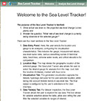
he U.S. Army Corps of Engineers (USACE) has released to the public a Sea Level Tracker tool which allows users to: (1) visualize observed sea level changes vs. projected sea level change scenarios, and (2) answer the question, "What rate of sea level change is currently being observed at the selected gauge?"
This USACE tool pulls authoritative data from the National Oceanic and Atmospheric Administration (NOAA, see link below), to enable the general public to visualize how sea level is changing at tide gauges in their state or region. The tool also provides value to multiple agencies, such as NOAA, who are interested in trajectory-tracking tools such as this to help understand past, current, and expected future conditions along the coastlines. Finally, the Sea Level Tracker tool assists USACE with incorporating sea level change into their Civil Works programs and projects, per Engineer Regulation (ER) 1110-2-8162, published in 2013 (see link below).
For those interested in more than the general trend of whether sea level has risen or is projected to rise, the tool enables users to select different datums, tidal statistics, and local sea level change rates, compute actual mean sea level (MSL) values and trends for specific tide gauges, visualize a variety of monthly means, and view historical MSL by either 19-year or 5-year midpoint moving averages, or both. Finally, users can also visualize linear trends and extreme water levels.
Learn More
- NOAA CO-OPS: Homepage for NOAA’s Center for Operational Oceanographic Products and Services (CO-OPS), which generates the data used for the USACE Sea Level Tracker tool
- ER 1110-2-8162: ER 1110-2-8162: Incorporating Sea Level Change in Civil Works Programs
- USACE Public Tools: USACE public sea level change tools
- USACE Sea Level Tracker Tool: Link to the USACE Sea Level Tracker Tool
|