IV. "The Force Consisted of Officers…Aided too by Professional Gentlemen Drawn from Civil Life"—Science and Engineering during the Wheeler Survey
| |
 |
| |
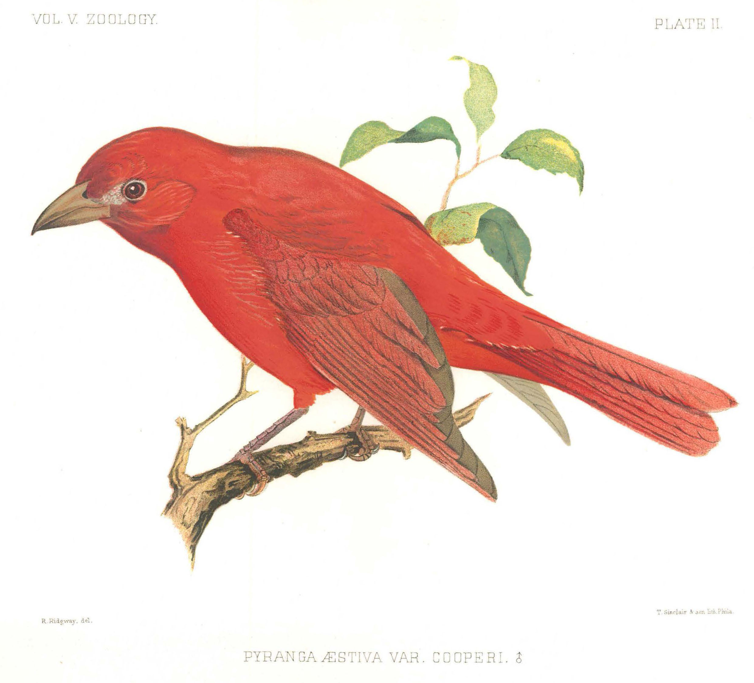
Sketch of a male Pyranga aestiva var. cooperi, Cooper's Tanager. Plate No. 2, U.S. Geographical Surveys West of the 100th Meridian, Volume 5: Zoology, Office of History
|
Late in 1874 in Washington, D.C., twenty-four-year-old Henry Wetherbee Henshaw presented the bird skins he had collected in southern Arizona that summer to the nation’s top ornithologists. The scientists were especially surprised by the number of tropical birds shown, and Henshaw noted a need to reassess those birds’ known geographical ranges.[1] Henshaw had gathered these birds while with the Wheeler Survey, a geographical and mapping expedition in the American West led by Lt. George Montague Wheeler, Corps of Engineers. Henshaw was part of the first American generation for which scientific and engineering education was readily available to civilians, as universities developed curriculum that rivaled that of the U.S. Military Academy. For these citizen-scientists, the American West offered a natural laboratory to conduct field research, develop and test new theories, and collect samples and artifacts, many of which they ultimately contributed to the fledgling Smithsonian Institution. To pursue these endeavors, many scientists sought employment with one of the ”Great Western Surveys,” where theory and practice converged.
The Wheeler Survey was by all accounts a military endeavor. Lt. Wheeler was on orders from the Chief of Engineers, Gen. Andrew A. Humphreys, and several infantry soldiers accompanied the team. Logistics and the issuance of equipment and food rations followed military procedures. However, the civilians in the survey party far outnumbered the military personnel owing to the dual nature of the mission: survey the land for topographical features to aid future military operations; study the climate, ethnography, and vegetation; and asses woodlands, minerals, water features, and other elements for their possible economic value. Over the course of its eight active years, the survey employed 115 civilians compared to 27 soldiers.
Instruments and Technique
Wheeler’s civilian scientists used devices that were typical of the 1870s. The group initially experimented with various surveying and astronomic instruments before settling on a standardized set for the 1876 field season. Astronomers used transits, zenith telescopes, sextants, chronographs, and telegraphs to gauge star positions. The topographers had theodolites, gradienters, levels and staffs, alt-azimuths, pocket sextants, and compasses. The meteorological assistants relied on cistern and aneroid barometers, hygrometers, thermometers, anemometers, and rain gauges to record weather and altitudes. The men used special equipment for collecting plants, animals, and mineral samples: powder and shot, insect nets, fishing tackle, alcohol tanks, and geological hammers.[2]
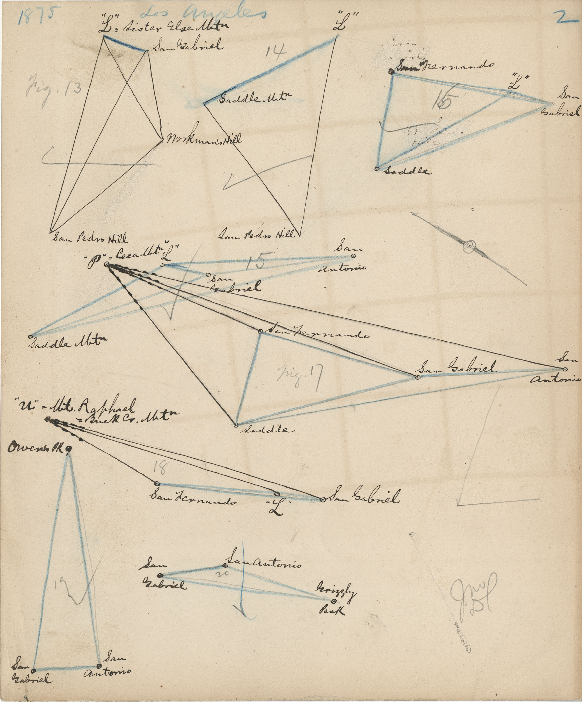
To create an accurate map of the American West, the Wheeler Survey’s field parties developed a triangulation network using mountain peaks and towns as vertices. The topographers ascended “prominent peaks, buttes, [and] mesa edges,” and, using a compass and theodolite, recorded the angles between north and points along the horizon, using trigonometry to calculate the distances between peaks. To increase the accuracy of the network, the topographers also took measurements along mountain slopes, atop minor peaks, and at towns and military outposts.
While Wheeler’s topographers climbed mountains, his astronomers visited towns across the West to determine their longitude and latitude. Between 1872 and 1874, these parties established observation sites at nineteen towns throughout Montana, Wyoming, Nebraska, Colorado, New Mexico, Utah, and Nevada, and they erected stone monuments there to serve as primary vertices of the triangulation network. The survey also built an observatory at Ogden, Utah, near where the transcontinental railroad was completed in 1869.
The astronomers used the Horrebow-Talcott method to calculate latitude and the “American method” for longitude. The former involved calculating the average difference in distance between two stars on either side of the meridian (the line running north-south) and the point directly overhead, a very accurate method. Using the “American method,” astronomers measured the difference in time a star crossed two local meridians. When one astronomer recorded the time of a star’s crossing in the field, he telegraphed another astronomer at an observatory.[3] After recording a predetermined number of stars, the two astronomers switched roles. They calculated the difference in longitude between the two sites as the difference in times of the stars’ crossings.[4]
 |

In 1873, members of the Wheeler Survey erected an observatory just outside Ogden, Utah, which served as a central hub for the survey in determining latitudes and longitudes in the region. The center of the building housed a telescope, while the wings held equipment and workspace. This photo is by the survey’s official photographer, Timothy O’Sullivan. National Archives
|
 |
|
Left and right: Computations of distances between mountain peaks and Los Angeles and Panamint City, California, taken during the 1875 field season of the Wheeler Survey
Office of History
|
Earth and Life Sciences
Members of the Wheeler Survey also undertook geological and natural history work. At mining districts, geologists noted the minerals and ores available and appraised their value. While traveling, they studied the physical landscape, noting the structure of the mountains they climbed and valleys they crossed. As such, Wheeler’s geologists contributed to the scientific study of the Great Basin and the Colorado Plateau. As for natural history, scientists and their assistants collected plant, animal, and fossil specimens, which they transferred to the Smithsonian Institution or universities for further study.
Unlike with zoology and paleontology, there were economic reasons for botany being part of the survey. While collecting plants, Wheeler’s botanists also studied the West’s timber resources and agricultural potential. Botanist Joseph T. Rothrock described the Rio Grande Valley as “one continuous agricultural area, unpromising in appearance but rich in vegetable life.” He noted that corn and wheat could be grown along the valley’s entire length, while grapes and apricots would thrive near Santa Fe.
 |
 |
 |
|
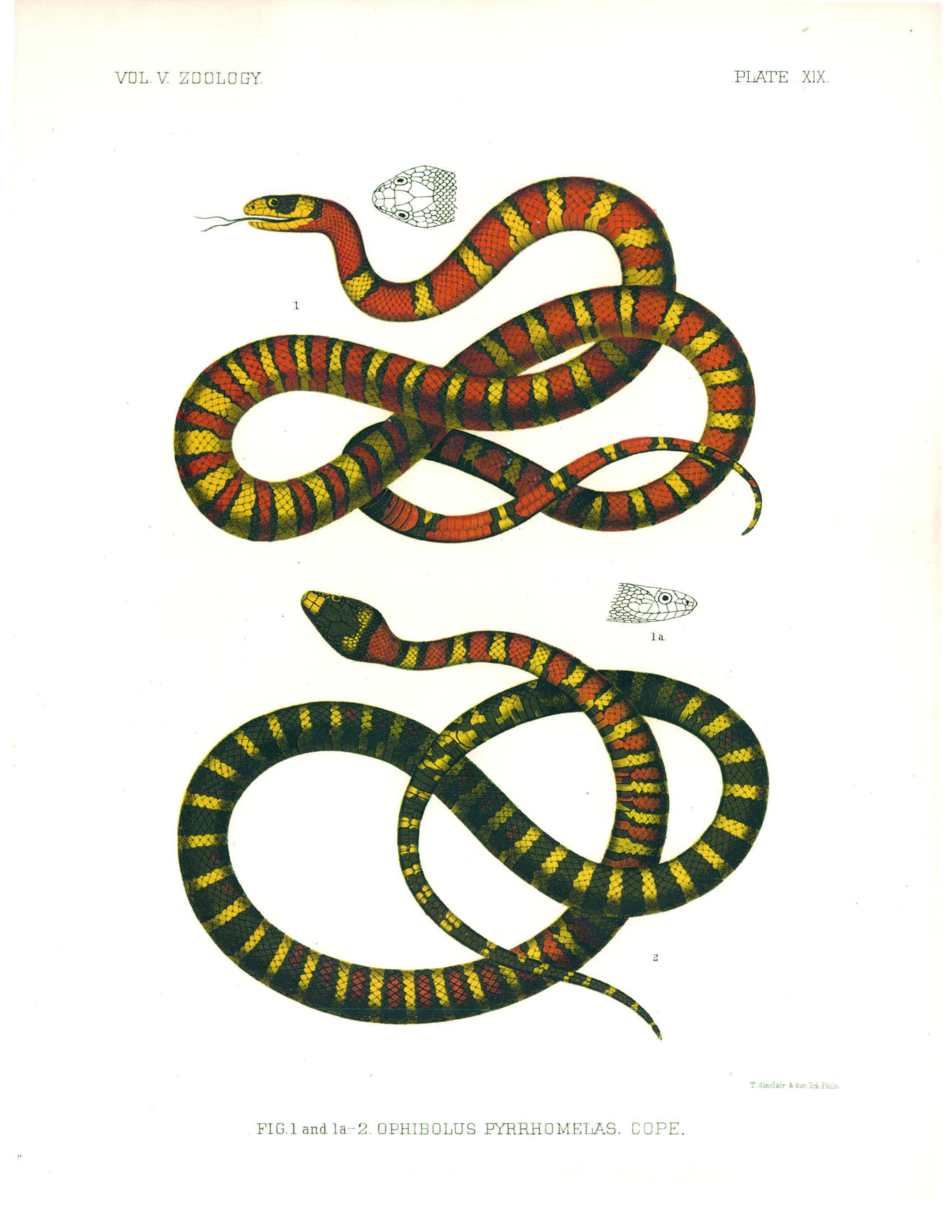
Sketch of Ophibolus pyrrhomelas Cope, the Arizona mountain king snake. Plate No. 19, U.S. Geographical Surveys West of the 100th Meridian, Volume 5: Zoology. Office of History.
|
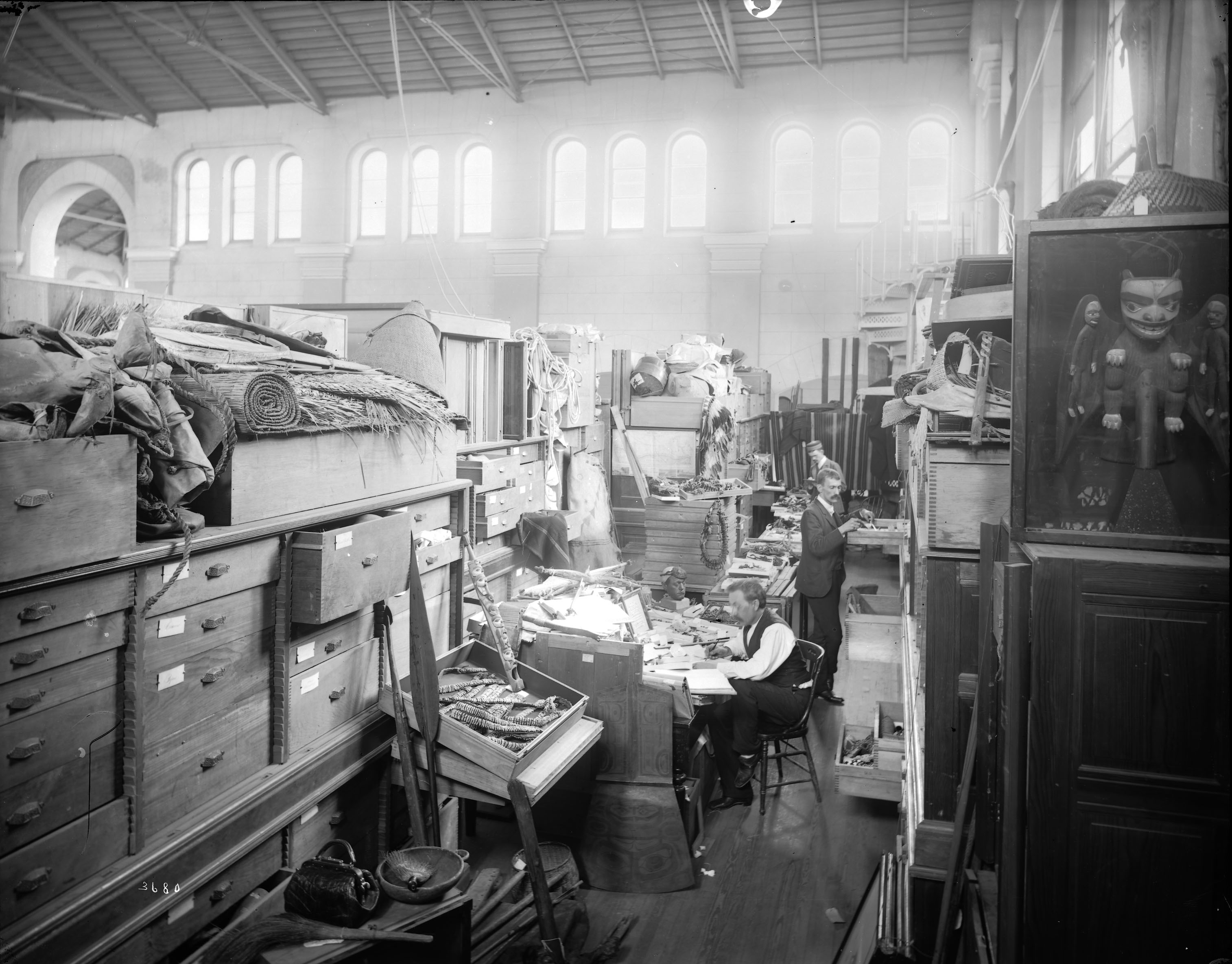
Men working in the ethnology collections storage area at the U.S. National Museum, now the Arts & Industries Building, ca. 1890s. The Wheeler Survey sent items to the museum for cataloging and further study. Smithsonian Institution Archives, Record Unit 95, Box 32, Folder: 19
|
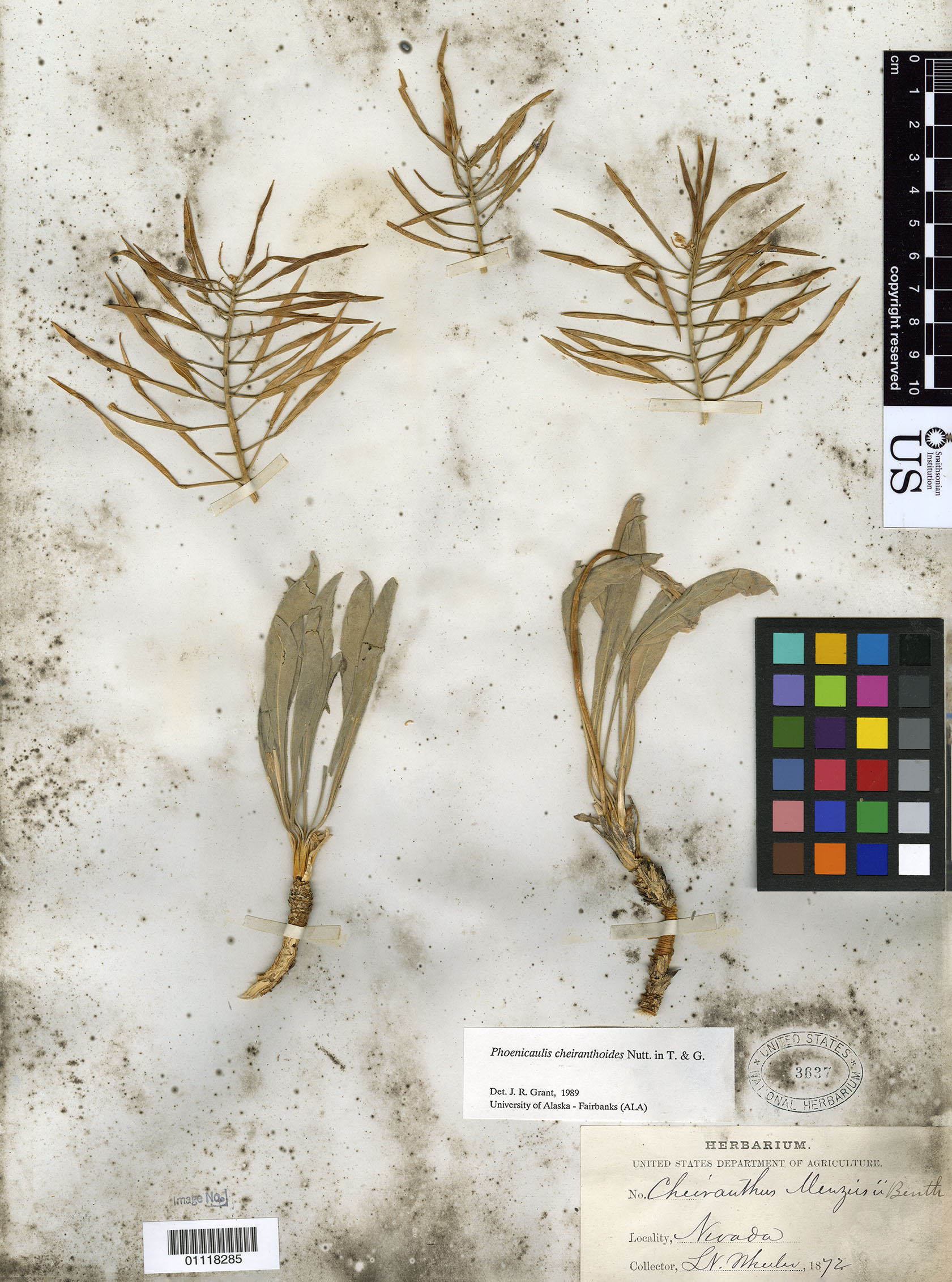
Plant samples collected during the Wheeler Survey in Nevada in 1872. Samples like these were sent back to the Smithsonian for cataloguing and future study. National Museum of Natural History
|
Perhaps the most controversial practice of the Wheeler Survey was in the field of ethnology. Some parties excavated Native American burial mounds, collecting artifacts and remains. In Santa Barbara, the survey found small pots, mortars and pestles, war-clubs, shells, and skeletons. In New Mexico, one party exhumed pots containing charcoal, dried corn, and the bones of small mammals and birds.[5] However, survey members also spent time in the pueblos of New Mexico and Colorado to document local languages and cultural practices. Topographer Francis Klett witnessed the rarely performed Cachina dance of the Zuni people,[6] and Timothy O’Sullivan photographed the lives and architecture of the Puebloans.
Although many of the surveys of the American West in the nineteenth century were primarily military in nature, the scientific aspects of the expeditions were undeniable. While mapping the region for the Army, civilian scientists also examined, recorded, and studied the natural and cultural environment. The knowledge thus gained—geographical, geological, paleontological, astronomical, botanical, zoological, and ethnological—was incalculable, and it did not remain in the sole custody of the Army. Thanks to the several published reports and atlases, and the future endeavors of survey members, the newfound knowledge soon melded into the canon of American science as a benefit to all.
[1] Edward William Nelson, “Henry Wetherbee Henshaw—Naturalist, 1850-1909,” The Auk, Vol. XLIX, No. 4 (October 1932): 407-408, https://sora.unm.edu/sites/default/files/journals/auk/v049n04/p0399-p0427.pdf.
[2] George M. Wheeler, “Methods of Survey,” in Geographical Surveys West of the One Hundredth Meridian, Volume 1: Geographical Report (Washington, D.C.: Government Printing Office, 1889): 360-361.
[3] These permanent observatories used by the Wheeler Survey were the Naval Observatory in Washington, D.C., the United States Lake Survey Observatory in Detroit, Michigan, or the observatory in Temple Square in Salt Lake City, Utah, and the Wheeler Survey’s own observatory in Ogden.
[4] W. E. Wilson, “Star crossings and stone monuments—Field astronomy by the Wheeler Survey in 1870s Colorado,” U.S. Geological Survey Circular 1362 (2010): 12-13.
[5] H.C. Yarrow, “Notice of a Ruined Pueblo and an Ancient Burial Place in the Valley of the Rio Chama,” in Report Upon United States Geographical Surveys West of the One Hundredth Meridian Volume Seven: Archaeology, ed. by George M. Wheeler (Washington, D.C.: Government Printing Office, 1879): 364.
[6] Francis Klett, “The Cachina: A Dance at the Pueblo of Zuñi,” in Report Upon United States Geographical Surveys West of the One Hundredth Meridian Volume Seven: Archaeology, ed. by George M. Wheeler (Washington, D.C.: Government Printing Office, 1879): 322.
Office of History's series of articles detailing the U.S. Geographical Surveys West of the 100th Meridian