I. "Partly Military, Partly Civil, Working Always in Harmony"—An Overview
| |
 |
| |
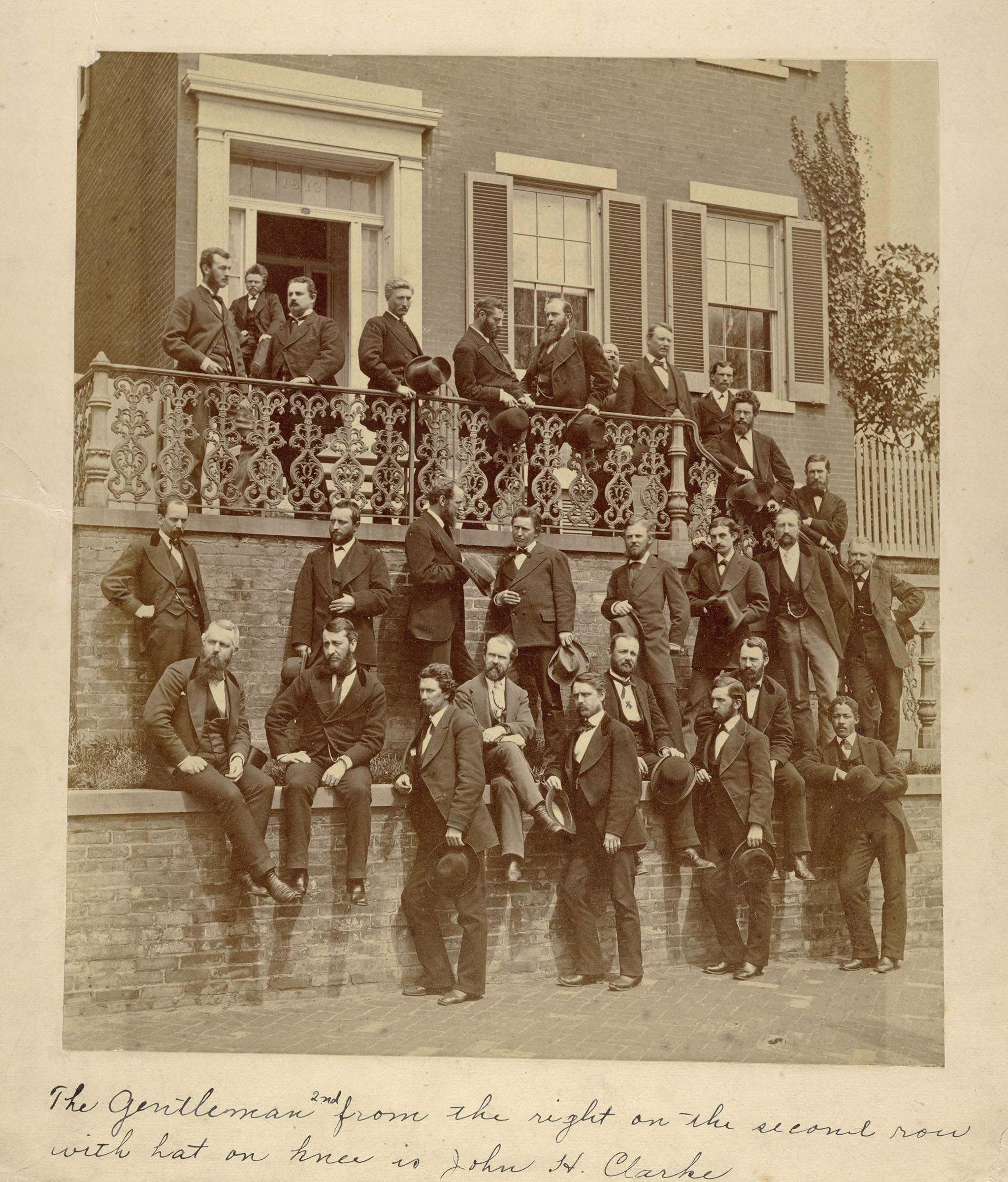
Wheeler Party Survey Members. Standing in the top row, sixth from the left, is George M. Wheeler, the West Point graduate who in 1871 developed a comprehensive plan for surveying the territory west of the 100th meridian.
National Portrait Gallery |
In spring 1871, a group of scientists, soldiers, and surveyors gathered on the dusty plains of northeast Nevada, near the town of Halleck on the transcontinental railroad, to participate in the first U.S. Army Engineer survey in the American West since the outbreak of the Civil War ten years earlier. The group’s goal was to map the entirety of the western half of the United States, a monumental task. Over the next nine years, the members of the United States Geographical Surveys West of the 100th Meridian would crisscross the West on foot, horseback, muleback, trains, and wagons.
The leader and architect of this survey was Maj. George Montague Wheeler, Corps of Engineers, from whom the expedition gets its nickname: “the Wheeler Survey.” In 1871, Wheeler was still a young first lieutenant, having graduated from the United States Military Academy at West Point in 1866 at the age of 24. While stationed in San Francisco, Wheeler learned the art of military mapmaking. He led his first reconnaissance into Nevada in 1869 where he first envisioned what would be become the Wheeler Survey.
Wheeler took his idea to Washington, D.C., where he garnered the support of western congressmen and Brig. Gen. Andrew A. Humphreys, then Chief of Engineers. Humphreys hoped to reestablish the Corps’ peacetime surveying mission, which was under threat from the Interior Department and other federal civilian agencies. In early 1871, Humphreys authorized Wheeler’s plan, ordering him to:
obtain correct topographical knowledge of … everything relating to the physical features of the country, the numbers, habits, and dispositions of the Indians who may live in this section, the selection of such sites as may be used for future military operation or occupation, and the facilities offered for making rail or common roads … the mineral resources that may be discovered … the influence of climate, the geological formations, character and kinds of vegetation, its probable value for agricultural and grazing purposes, relative proportions of woodland, water, and other qualities which affect its value….[1]
Based on Humphreys’ orders, Wheeler’s mission was as much a scientific and economic expedition as it was a mapping survey, so Wheeler hired professionals in a range of scientific disciplines—astronomy, botany, chemistry, ethnology, geology, paleontology, and zoology. Additionally, Wheeler employed topographers and surveyors to supplement his subordinate Army officers. During the nine years of the survey, the number of civilians it employed greatly outweighed the number of Army officers: 115 scientists, surveyors, and their assistants, compared to only 27 military officers.
To garner public support and secure congressional appropriations, Wheeler hired Civil War photographers William Bell and Timothy O’Sullivan to document the West’s landscapes and native inhabitants. Their work, much of it later published, represents some of the first government-sponsored photography of the American West and its people.
 |
|
 |
| A page from the Organization and Equipment Book showing the types of rations and provisions acquired for the 1878 survey season. Office of History |
|
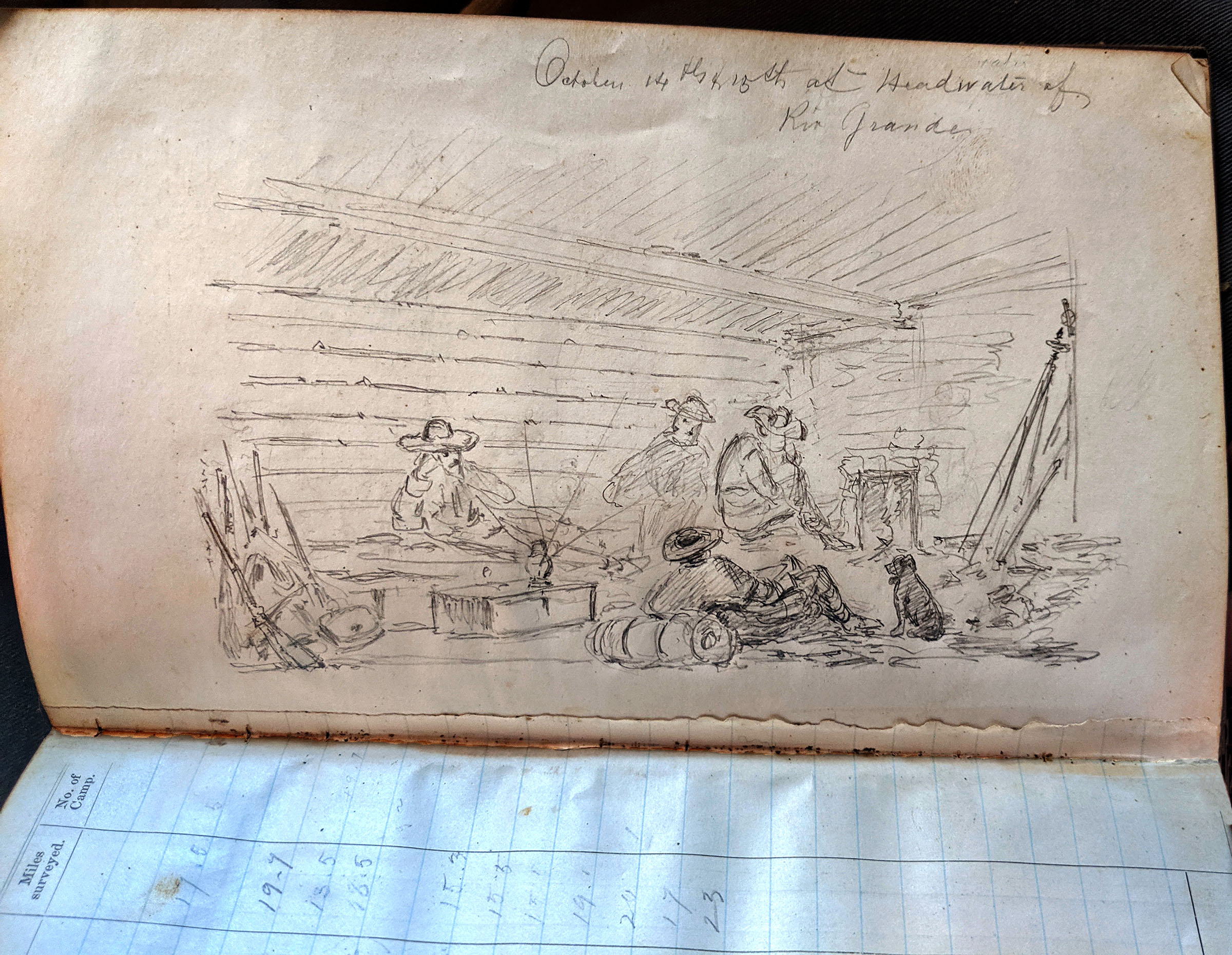
Sketch by Francis Klett, assistant topographer and clerk during the first year of the Wheeler Survey, 1871. The handwriting at the top of the page reads “October 14th & 15th at the headwaters of the Rio Grande.” National Archives |
Unfortunately, George Wheeler’s expeditions ended before he reached his goal of mapping the entire western United States. In the spring of 1879, Congress consolidated federal surveying efforts into the United States Geological Survey, which, as part of the Interior rather than the War Department, would thenceforth oversee such geological and topographical expeditions. On June 30, 1879, Wheeler’s ambitious plans ended as Congress declined to appropriate money for further Army field work.
By then the Wheeler Survey had mapped an area covering 359,065 square miles, from Texas to Idaho to California. It had studied 1,149 individual mountains, identified the position of 1,875 stars, and examined the effects of glaciers and volcanoes. Wheeler’s botanists, paleontologists, and zoologists had collected more than 100,000 specimens, while his ethnologists had documented the languages of the Puebloans in Colorado and New Mexico. Additionally, the survey had classified approximately 175,000 square miles to aid in future settlement of the region. The government ultimately published all these findings in an eight-volume set with accompanying atlases. What Wheeler, his officers, and his civilian employees accomplished is a testament to the strength of the military-civilian relationship that persists within the Corps of Engineers. Many participants applied the experience they gained during the government-sponsored scientific expeditions to their future endeavors, amplifying the value of the survey and spreading knowledge into the civilian sector. In Wheeler’s own words, the survey under his command was “partly military, partly civil, working always in harmony.”[2]
| Butterflies - Argynnis Nokomis |
 |
|
Argynnis Nokomis. According to the survey’s final report, “specimens of this magnificent insect were brought by the expedition from Arizona in 1871. Until that time but a single male was known—from the Bitter Root Mountains of Montana.”
Plate No. 35, U.S. Geographical Surveys West of the 100th Meridian, Volume 5: Zoology, Office of History
|
[1] A. A. Humphreys to George M. Wheeler, Departmental Instructions, March 23, 1871, Geographical Report, 31-32.
[2] George M. Wheeler, “Address of George M. Wheeler, U.S. Army Corps of Engineers, December 23, 1874, before the American Geographical Society” (New York: American Geographical Society, 1874): 7.
March 2021. No. 142.
Office of History's series of articles detailing the U.S. Geographical Surveys West of the 100th Meridian