II. "Their Works are Passing into History"—U.S. Army Surveys and the Great Surveys of the American West
| |
 |
| |
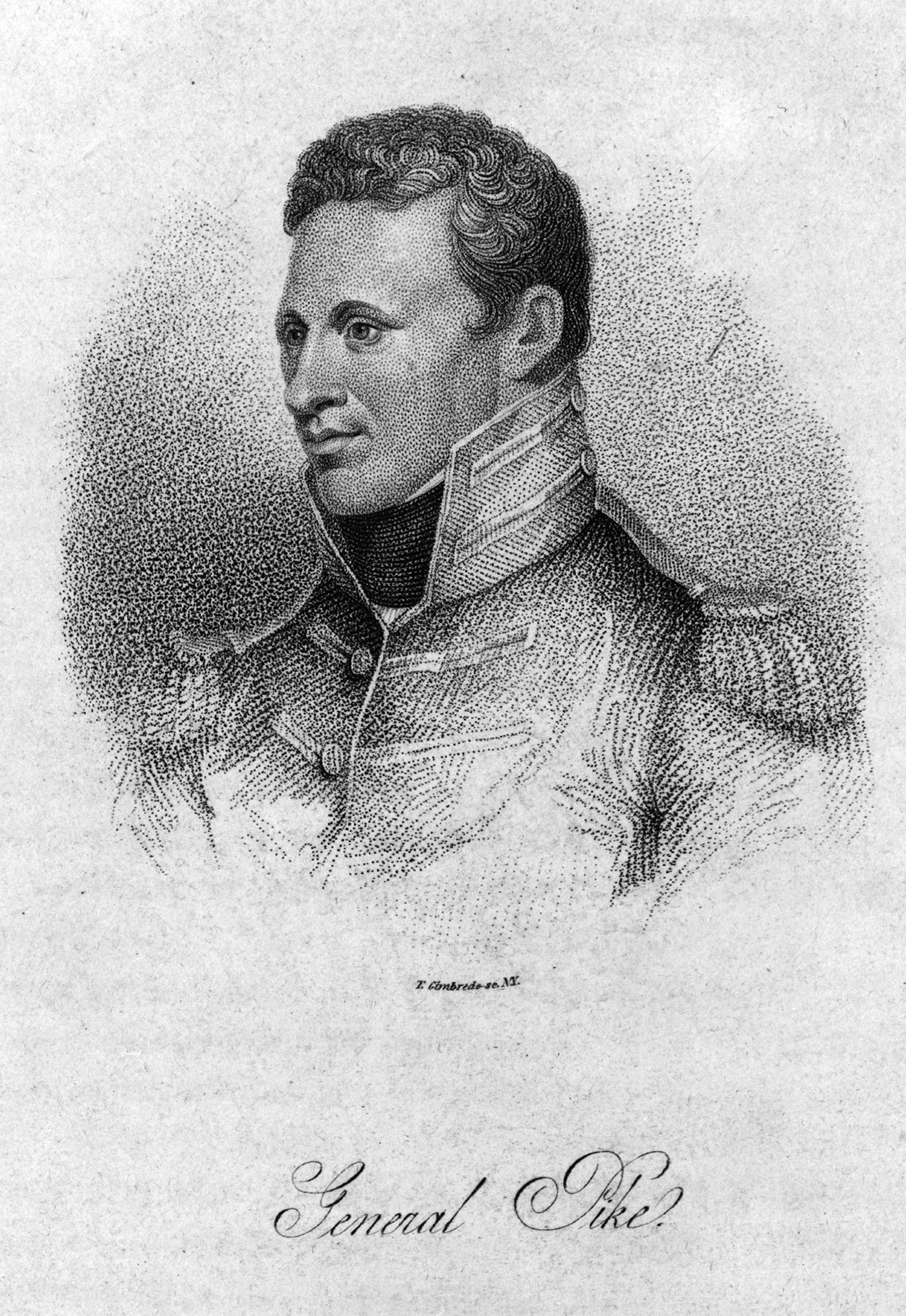
Zebulon Pike, ca. 1812
Library of Congress, P&P
|
When First Lt. George Montague Wheeler set out from Halleck Station, Nevada, in 1871, he was leading what would become the U.S. Army Corps of Engineers’ most ambitious, and final, exploratory surveys. Likely unknown to him and his fellow Army officers, “the Wheeler Survey” (actually a series of expeditions between 1871 and 1879) would culminate nearly sixty years of Army surveying for the federal government. Three other surveys underway during this same timeframe—those under the direction of civilians Clarence King, Ferdinand V. Hayden, and John Wesley Powell—would lead to the creation of the United States Geological Survey and the transfer of surveying and exploration duties to civilian control. These four surveys came to be known as the Great Surveys of the American West.
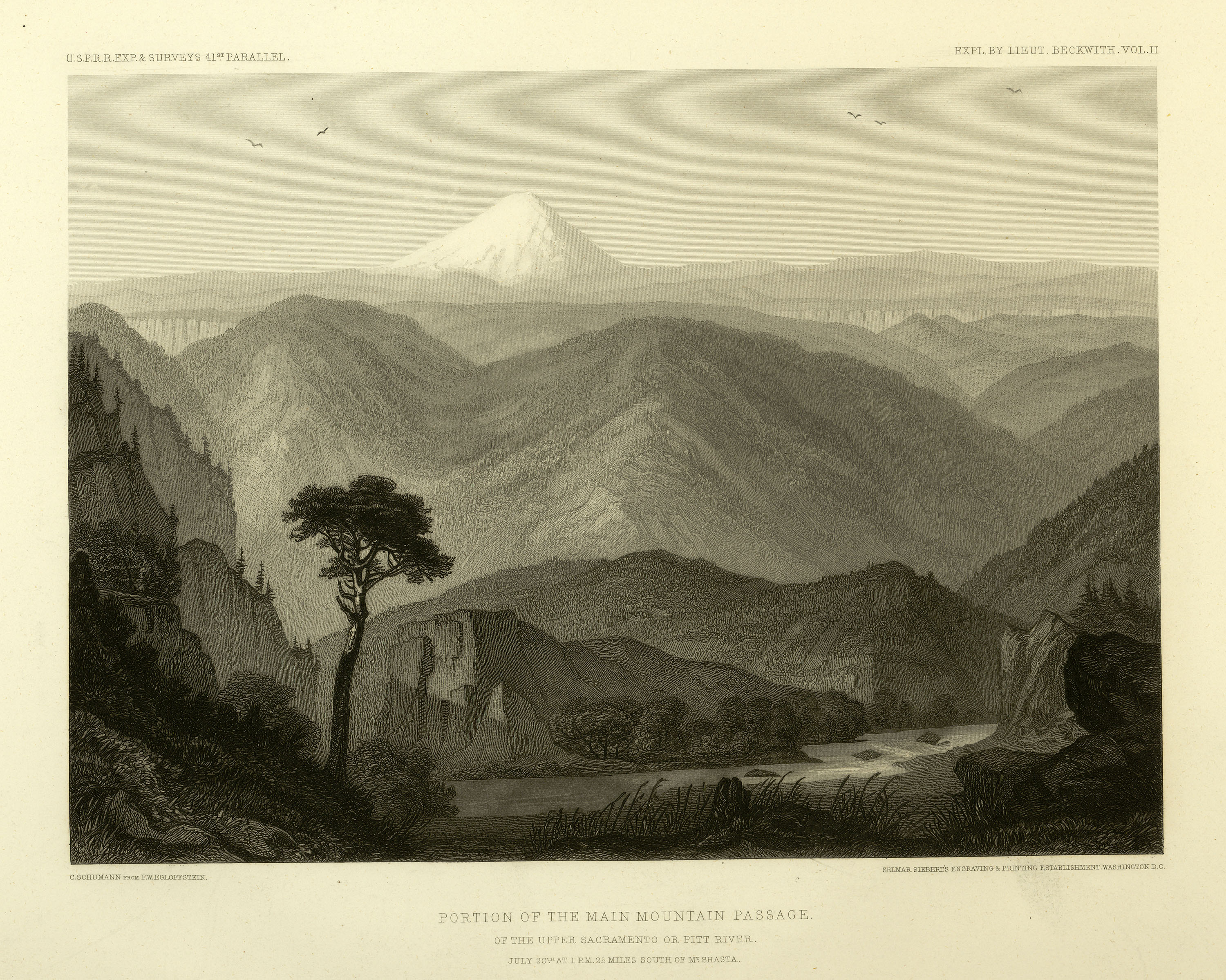
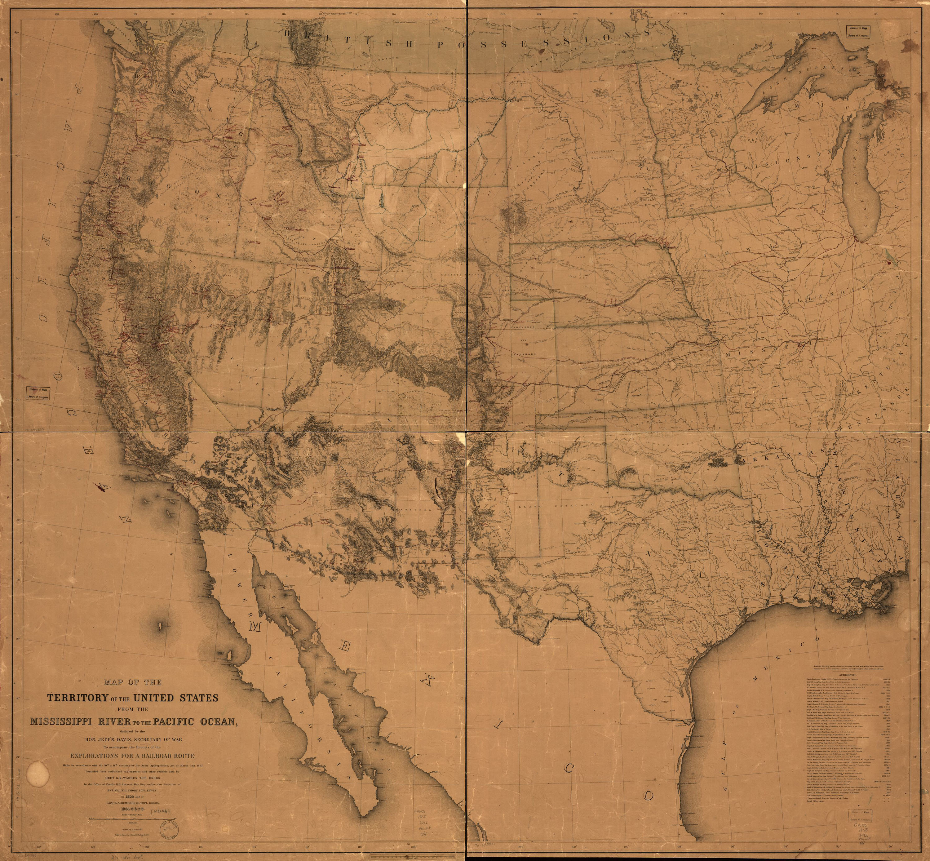
Between the Lewis and Clark expedition in 1803 and the beginning of the Civil War in 1861, Army engineers undertook numerous ventures into “unknown” territory: Lt. Zebulon M. Pike’s recon of the Rocky Mountains; Lt. John C. Fremont’s three expeditions across the Rocky Mountains; Lt. William H. Emory’s surveys from Fort Leavenworth to San Diego; and Lt. Howard Stansbury’s exploration of the Great Salt Lake. In the decade before the Civil War, Lt. John N. Macomb laid out New Mexico’s basic road network, Lt. George H. Derby began harbor improvements in California, and Lt. Joseph C. Ives was the first Anglo-American to descend the Grand Canyon. Engineers also undertook their most ambitious expedition to date—the Pacific Railroad Surveys, which consisted of four separate parties searching for a safe route for the transcontinental railroad; a fifth party surveyed along the Pacific coast between California and Washington. Lt. Gouverneur K. Warren led the last major Engineer expedition of the 1850s which produced a comprehensive map of much of the territory west of the Mississippi River. The outbreak of the Civil War ended this great era of Army exploration as the Army recalled many of its officers back East to lead battlefield units.
 |
|
 |
|
Pacific Railway Survey, "Portion of the Main Mountain Passage"
Lithograph from the Railway Survey Report, 1853-1856, Office of History
|
|
Gouverneur K. Warren’s Map of the West, 1858
Library of Congress, Geography and Map Division |
When the war ended in 1865, the U.S., in concert with the Army Engineers, once again set its sights on the western horizon. The dramatic growth of the population in the West, territorial clashes, industrialization, and the emergence of civilian-dominated science, all encouraged the government to begin systematic examinations of western resources. However, a new class of university-educated civilian scientists challenged the primacy of Army Engineers in surveying. In 1867, the first of the four Great Surveys began under the leadership of geologist Clarence King, a Yale graduate. His survey focused on a 100-mile-wide band along the 40th parallel, roughly coinciding with the path of the transcontinental railroad.
Following King were two other geologists: Ferdinand V. Hayden and John Wesley Powell. A veteran surveyor, Hayden spent the mid-1850s collecting fossils along the upper Missouri River and accompanying Army Engineer Gouverner K. Warren on his expeditions in Nebraska Territory. In 1867, Congress instructed Hayden to survey the new state of Nebraska and the surrounding territory. Hayden’s survey was so successful that Congress appropriated funds in 1868 and 1869 to survey Colorado and Wyoming. Also in 1867, Powell began exploring the Rocky Mountains in Colorado and eastern Utah. In 1869, he led a privately financed expedition down the Colorado River through the Grand Canyon. In 1870, Congress funded Powell’s second trip down the Colorado, and in 1872, the completion of his survey of the southwest’s canyonlands. Although the Corps of Engineers had supervised the King Survey, the Hayden and Powell Surveys fell under the jurisdiction of the Department of the Interior.
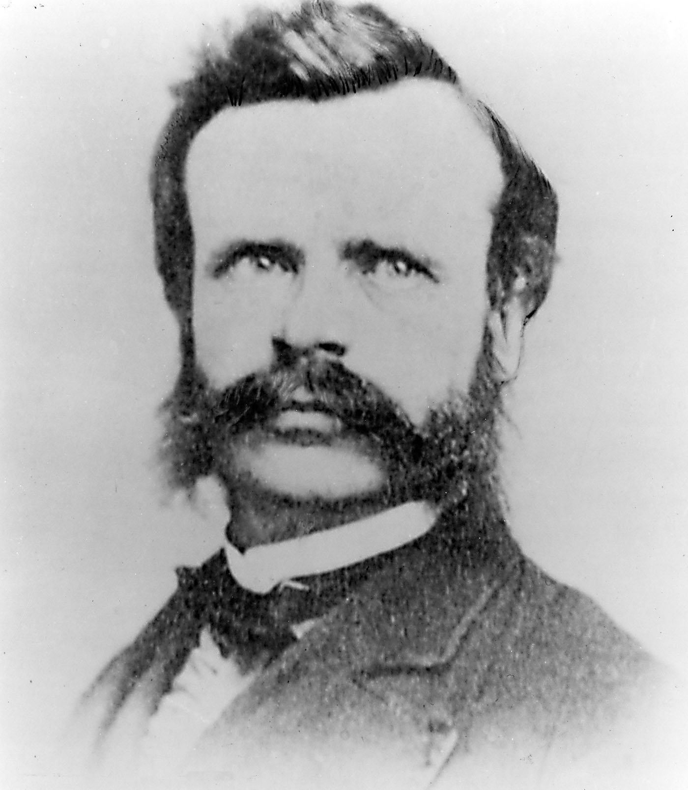
John Wesley Powell, ca. 1869, the same year he began exploring the Rocky Mountains and the Colorado River
U.S. Geological Survey, Denver Library Photographic Collection
|
 |

Clarence King led the first of the four Great Surveys along the 40th parallel beginning in 1867 and served as the first director of the USGS from 1879 to 1881.
U.S. Geological Survey
|
|
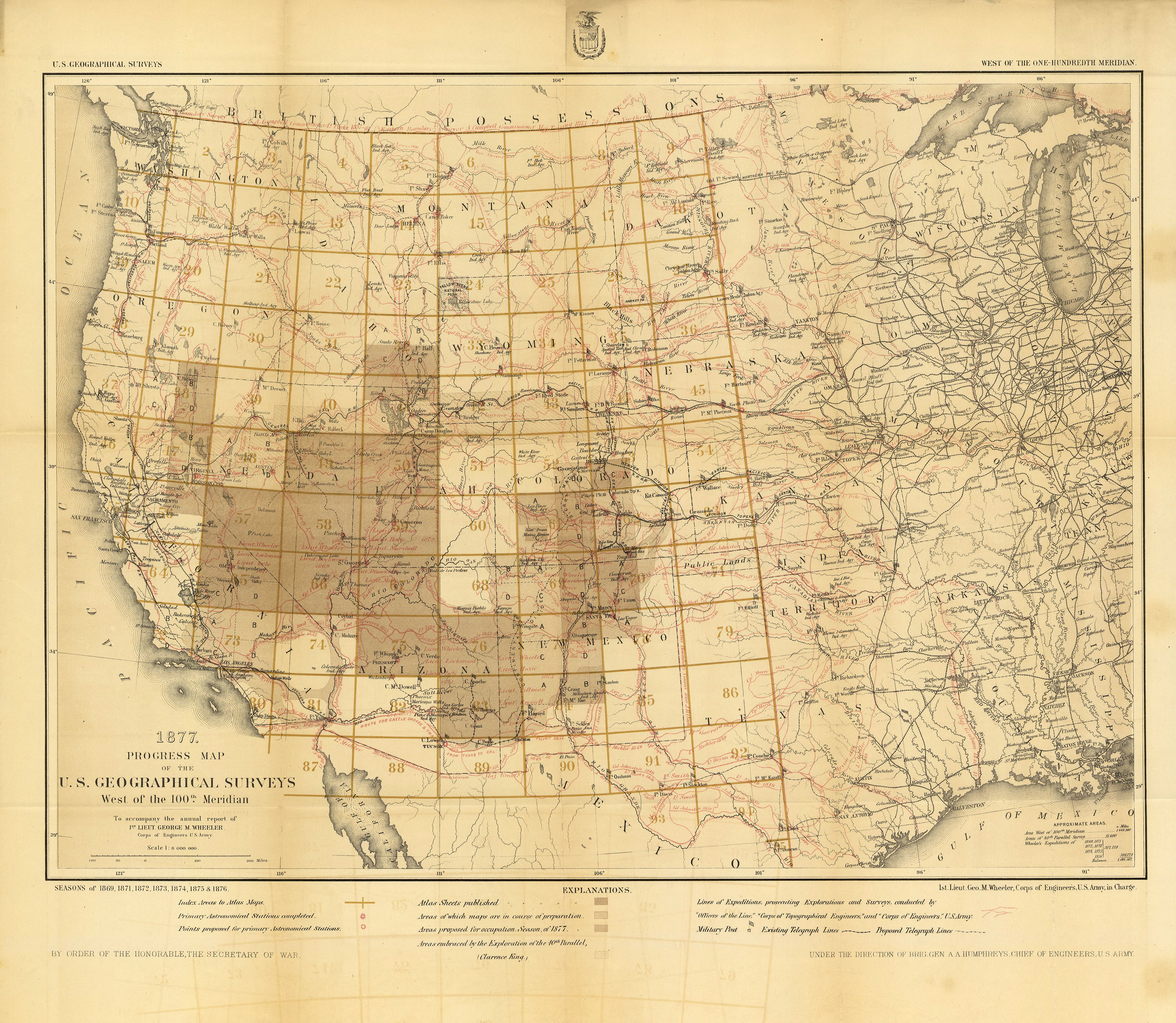
Topographical Atlas Sheet showing Wheeler’s ambitious plan to survey all the territory west of the 100th meridian. The lightly shaded area along the 40th parallel shows where the Clarence King Survey operated.
To Accompany the Annual Report of the Chief of Engineers, 1877, p. 1245, Office of History
|
By 1870, Brig. Gen. Andrew A. Humphreys, Chief of Engineers, felt the threat of the civilian-led surveys, believing they imperiled an important peacetime mission of the Corps of Engineers. When Humphreys heard of Lt. George Wheeler’s plan for a grand survey of the West, he quickly endorsed the idea. On May 3, 1871, the Geographical Surveys West of the 100th Meridian officially began. Its mission was to create an atlas of all the U.S. territory west of a line running through North Dakota, South Dakota, Nebraska, Kansas, Oklahoma, and Texas.
During the survey’s nine years, Wheeler maintained a heated rivalry with Powell and Hayden. Despite both having former ties to the U.S. Army, Powell and Hayden continually criticized Wheeler for unscientific surveying methods. In the spring of 1874, this feud came to a head in the halls of Congress, when an investigation concluded Wheeler was duplicating Hayden’s work in Colorado. Congress forced Wheeler to reevaluate his survey techniques and restricted his geographical range.
 |
 |
|
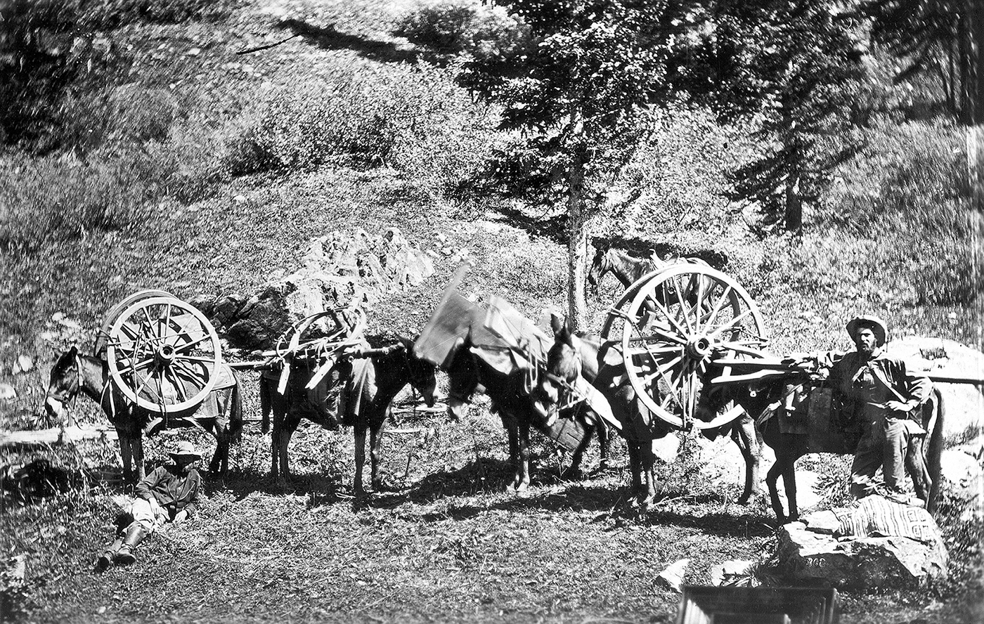
Hayden Survey members in southwest Colorado, 1875,
showing a disassembled wagon packed on mules to be transported
over rugged portions of the San Juan Mountains
U.S. Geological Survey, Denver Library Photographic Collection
|
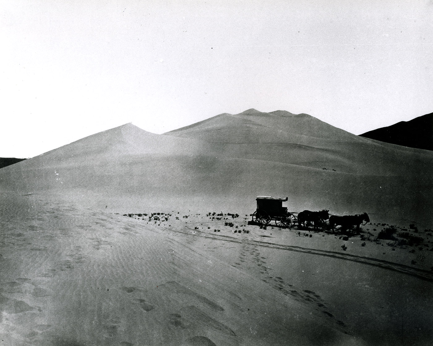
The King Survey party making its way across the Nevada dunes, 1867,
Timothy O'Sullivan, photographer
National Archives, 77-KS-3-160 and 77-KN-108
|
For five years, control of the western surveys hung in a delicate balance. Congress pushed the question of leadership onto the National Academy of Sciences, which was dominated by civilian professionals. In the spring of 1878, Othniel C. Marsh, a paleontologist and professor at Yale, assumed the presidency of the academy. While his predecessor, John Henry, had encouraged cooperation between competing surveys and their sponsoring agencies, Marsh held strong anti-military views. President Marsh asked the academy to review for Congress the possible consolidation of the western surveys. In turn, the Academy of Sciences recommended the creation of a civilian bureau, the United States Geological Survey, to “study the geological structure and economic resources of the public domain.” Congress agreed, appropriated funds, and appointed Clarence King as the first director of the new agency. On June 30, 1879, lacking appropriations, the Wheeler Survey folded, and with it ended the era of major U.S. Army Engineer exploration of the American West.
|
"Their works are passing into history..." —
George M. Wheeler to the American Geographical Society of New York, Dec. 23, 1874
|
♦ Biographical Sketch of Wheeler ♦
May 2021. No. 143.
See: Frank N. Schubert, Vanguard of Expansion: Army Engineers in the Trans-Mississippi West, 1818-1879, “The Great Surveys and the End of an Era,” (Washington, D.C.: Government Printing Office, 1989).
Office of History's series of articles detailing the U.S. Geographical Surveys West of the 100th Meridian