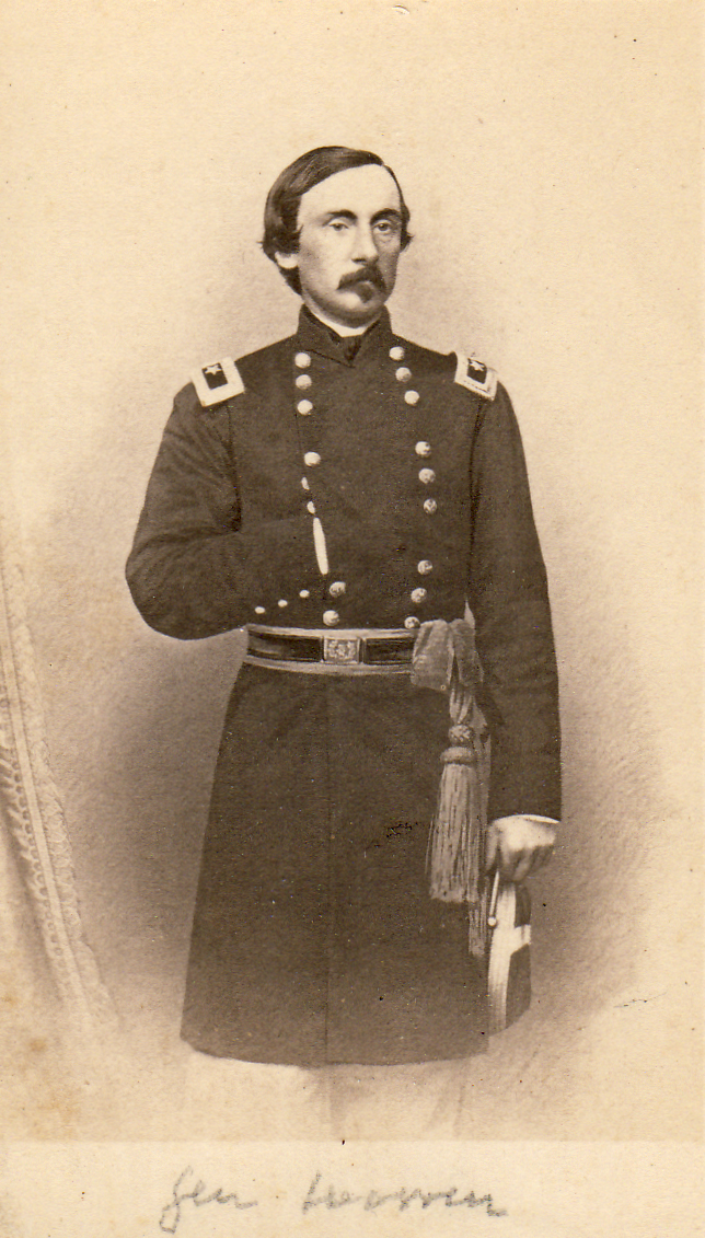
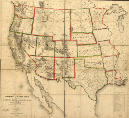
 The “Savior of Little Round Top,” Gouverneur K. Warren of the Corps of Topographical Engineers, drafted the first comprehensive map of the American West, a key landmark in American cartography.
The clever and meticulous Gouverneur K. Warren graduated from West Point in 1850, second in his class of forty-four. He had already earned a reputation for uncommon intelligence and ability when he joined the Office of Pacific Railroad Explorations and Surveys four years later. These surveys were a grand Western reconnaissance extending over half a continent and led by officers of the elite Army Topogs. Their purpose was to identify the most suitable route for the nation’s first transcontinental railroad. Under the immediate supervision of Capt. William H. Emory and, later, Capt. A. A. Humphreys, Warren directed his efforts at developing a comprehensive map, an enormously ambitious effort to synthesize information from the new surveys with fifty years of Army cartography in the Trans-Mississippi West. The process was painstaking and tedious, and Warren evinced remarkable zeal for the task, working long hours and often late into the night.
His work continued uninterrupted for over a year when he received orders to accompany Gen. William S. Harney on an expedition into Sioux country. Trekking west through the Platte Valley, he carefully mapped the route and conducted brief explorations to the north. He also experienced his first military engagement in a one-sided affair called the Battle of Ash Hollow. In its aftermath, Warren gathered up a treasure of Sioux artifacts and clothing and shipped them off to the Smithsonian Institution. Fully enamored with life in the field, he returned to the Great Plains in 1856 and 1857 and relegated his important work on the general map to intervening winters in Washington.
He completed the general map, as it was known in the War Department, in May 1857, though he continued to update it even after the Civil War. This remarkable achievement laid bare for the first time the basic contours of the vast American West and was a major landmark in American topography. Its significance went well beyond the Pacific Railroad surveys, and it remained the basic map of the Western states and territories for a generation.

Map of the territory of the United States from the Mississippi River to the Pacific Ocean.
Compiled by G. K. Warren; Drawn by E. Freyhold (1858).
Library of Congress, Geography and Map Division.
* * *
September 2009