After the Civil War, the Corps of Engineers placed officers on the staffs of the Division and Department Commanders in the West. As staff officers they had dual missions: support field operations and collect topographical data for the Engineer Department in Washington. Lieutenant Reuben Pietriken, Chief Engineer, Department of the Platte, surveyed routes from Fort Russell west to Fort Laramie and the Bozeman Trail forts in 1876.
In the early 1870s, Lieutenant Ernest Ruffner, Chief Engineer, Department of Missouri, accompanied 5th and 6th Cavalry expeditions to survey and map the area between the Platte and Arkansas rivers. In 1872, Major John Barlow, Chief Engineer, Division of Missouri, accompanied railroad surveyors into the Yellowstone River valley and accumulated enough topographical data to publish a map of the river.

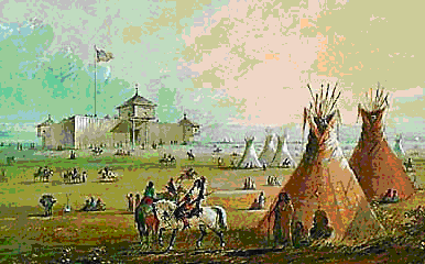
Painting by Alfred Miller depicts early life on Fort Laramie
In 1873 the War Department ordered the Engineer Department to make an itinerary of every reconnaissance for posting on a master map in Washington. Thus, Captain William Ludlow, Chief Engineer, Department of Dakota, accompanied Lieutenant Colonel George A. Custer’s 7th Cavalry into the Black Hills in July 1874. When Ludlow’s report, noting small amounts of gold, reached eastern newspapers, prospectors flowed into the Hills. When the Sioux refused to sell the Hills, the Grant administration gave them until February 1876 to evacuate and move onto reservations. After that, any Sioux found off a reservation would be considered hostile and an Army responsibility. Thus began the 1876 campaign, to include Custer’s demise on Little Bighorn.
 |
|
 |
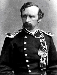
| Lt. Col. George A. Custer |
|
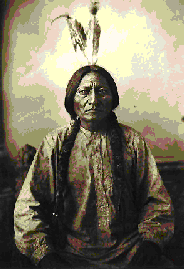
Sitting Bull, a Sioux Chief at Little Bighorn |
There were three columns in General Philip Sheridan’s plan to drive the Sioux onto reservations. Colonel John Gibbon’s Montana column left Fort Ellis on 1 April with 2d Cavalry Lieutenant Edward McClernand as acting engineer. Brigadier General Alfred Terry’s Dakota column left Fort Lincoln on 17 May with Lieutenant Edward Maguire, Chief Engineer, Department of Dakota, and a detachment from the Battalion of Engineers. Brigadier General George Crook’s column left Fort Fetterman on 29 May with Captain William Stanton, Chief Engineer, Department of the Platte. Crook fought a large force of Sioux and Cheyenne on 17 June along the Rosebud River. Terry, knowing nothing of Crook’s fight, sent Custer south along the Rosebud with 7th Cavalry Lieutenant George Wallace as acting engineer. Maguire and the engineer detachment went with Terry’s staff in Gibbon’s column southwest to the mouth of Little Bighorn. When Custer and five companies of the 7th Cavalry perished on 25 June 1876, Wallace was with the remainder of the regiment and survived the fight.
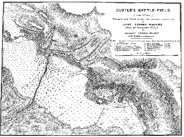
Maguire reached the battlefield on 27 June, and while the relief force tended the wounded and buried the dead, he mapped the field and the burial site. All Engineer reports on the Rosebud and Little Bighorn fights are recorded in the Annual Reports of the Chief of Engineers. Maguire’s map (below) became the basis for all maps of that historic battlefield.

* * *
July 2001