Pittsburgh is the greatest inland river port in this country, and one of the greatest in the entire world. In its location
at the head of the Ohio River, and in its utilization of unequaled water facilities, Pittsburgh exemplifies
more than any other river port the results that we seek in developing and improving our natural river channels.
- Lt. Gen. Raymond A. Wheeler, Chief of Engineers, 1946 |
| |
 |
| |
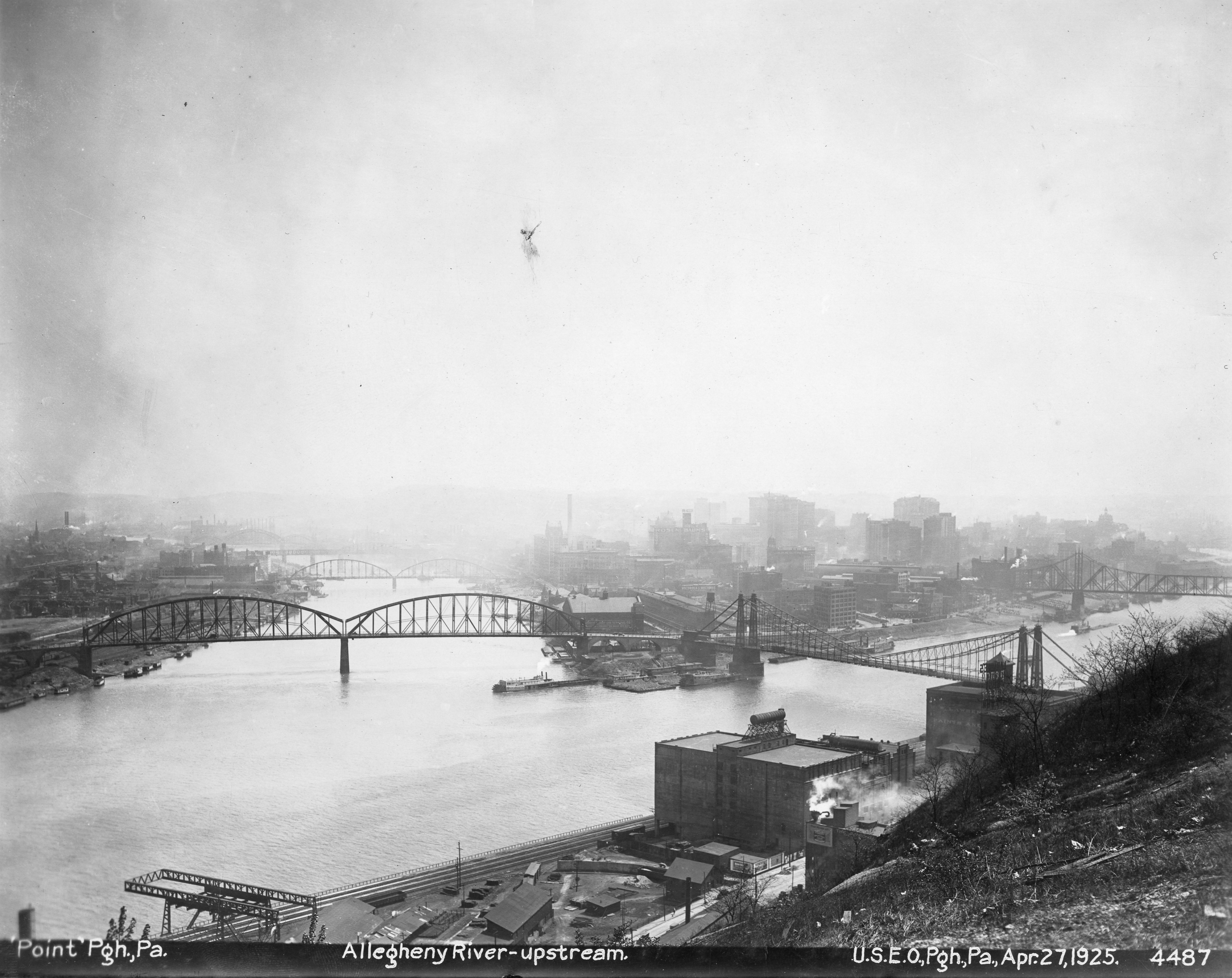
Downtown Pittsburgh, PA, in 1925, looking at the “Point,” or confluence of the Allegheny and Monongahela Rivers and the beginning of the Ohio. Pittsburgh was a key industrial and transportation center in the 1920s, with a population of 670,000. Pittsburgh District Photo
|
Office of History is currently working with the Pittsburgh District to preserve and digitize a collection of approximately 30,000 historic photographs that depict the district’s work on the waterways of western Pennsylvania, West Virginia, and eastern Ohio from 1905 to 1990. These extraordinary photos document a century of dedication to the region’s economic development and water resources. They show workers building locks and dams, bridges, and flood protection systems. They portray commerce on the region’s rivers and recreational activities at new lakes. The photos also show how civil works projects through the decades have bolstered the region's resilience and economic vitality.
Two centuries ago, one of the first civil works projects the U.S. Army Corps of Engineers undertook was clearing out hazardous sandbars on the Ohio River below Pittsburgh. In 1824 the first Rivers and Harbors Act authorized improvements to the Ohio River because it was a key waterway for settling the new states and territory of the country’s great “northwest.”
The Corps remained dedicated to making navigation improvements in western Pennsylvania as Pittsburgh transformed from a small, fortified trading post into an industrial metropolis in the late nineteenth century. The first lock and dam the Corps built on the Ohio River was at Davis Island five miles downstream from Pittsburgh, completed in 1885. Over the next 44 years the Corps would build 52 more locks and dams to create a 9-foot channel all the way to the Mississippi and turn the Ohio River into a reliable, year-round commercial waterway. Davis Island Lock and Dam was the largest movable dam, with the widest lock chamber, built in the nineteenth century. It helped ensure that Pittsburgh’s steamboats, towboats, and barges could still use the river during dry periods, which in the past had often left them landlocked and led to shuttered mills and factories waiting for supplies. Ending the disruptions of the dry months supported the region’s economic development. Today a modernized inland waterway navigation system in the Pittsburgh region continues to provide more than $450 million in economic benefits annually.
An expanded mission for the Corps followed the devastating spring 1936 flood in western Pennsylvania, which inundated 60 percent of downtown Pittsburgh and damaged 100,000 buildings. More than 200 people died. Regional damages approached $250 million ($6 billion in today’s dollars). The Flood Control Act of 1936 assigned the Corps of Engineers the nationwide mission to reduce flood damages, and it specifically authorized nine reservoirs in the Allegheny River basin above Pittsburgh to mitigate future catastrophes. The first two dams built, at Crooked and Tionesta Creeks, were completed ahead of schedule in 1940. The Pittsburgh District eventually constructed a system of 16 flood control reservoirs and 42 local protection projects, which have prevented over $16 billion in damages since their completion in 1965. From their earliest days these new lakes in the mountains served as recreational destinations, with more than 4 million visitors per year, adding nearly $140 million in value to the region’s economy in 2023.
Pittsburgh District is an exemplar of the effort to preserve valuable historic imagery to provide visual evidence of the past, helping us understand the history and development of critical infrastructure projects. These images offer insights into the challenges faced and the ingenuity employed in building crucial structures, among the earliest in the nation. By showcasing the evolution of technology and techniques, historic photos highlight the dedication and hard work that went into regional economic development. They help tell compelling stories that connect past accomplishments with present and future endeavors.
***
February 2025. No. 168.