| |
 |
| |
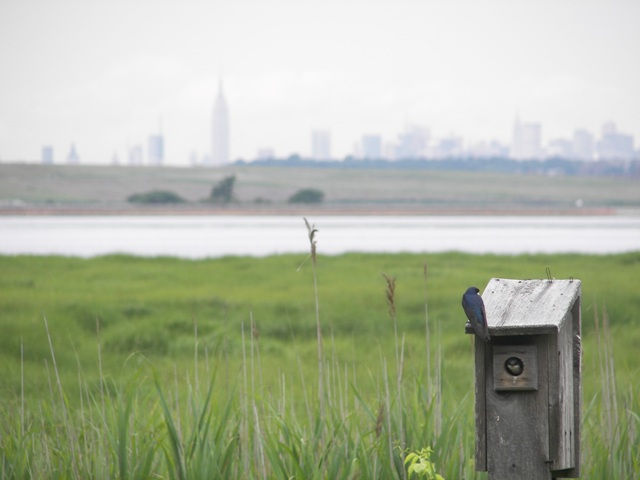
The dwindling of salt marshes in Jamaica Bay, Queens, New York, endangered a critical wildlife habitat, 2012. Gateway National Recreation Area, NPS Photo |
| |
 |
| |
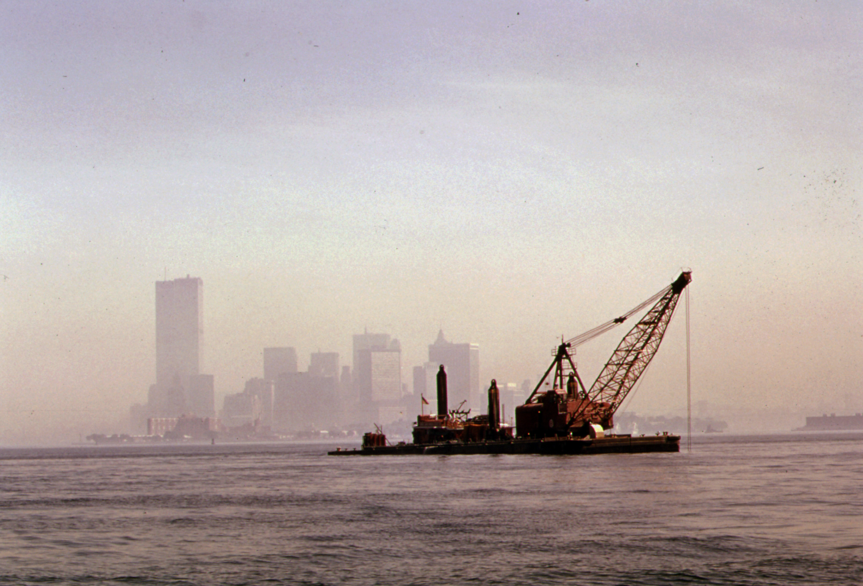
A USACE dredge maintaining navigation channels in New York Harbor, 1974. Over many decades, toxic sludge from New York’s water treatment plants had accumulated on the bottom of the harbor, and dredging disturbed this material, causing environmental impacts that required mitigation under the Clean Water Act. National Archives 555807 |
The U.S. Army Corps of Engineers (USACE) Dredged Material Research Program marked the beginning of a new era in how the federal government dealt with the material it dredged from rivers and harbors. The Clean Water Act of 1972 required that any disposal of dredged material would have minimal impact on the environment. As a result, the USACE New York District developed a plan to use dredged material, rather than just dispose of it, to restore dwindling marsh islands in Jamaica Bay on Long Island.
The 1970 Rivers and Harbors Act authorized USACE to study its methods and procedures for disposal of dredged materials, which at the time amounted to approximately 400 million cubic yards each year. In 1973, USACE began the Dredged Material Research Program (DMRP). Led by USACE Waterways Experiment Station, the DMRP lasted for five years and cost around $33 million. In addition to its findings on the need for increased oversight in the selection of placement alternatives, including beneficial uses of dredged materials, the study recommended better techniques for building and managing confined disposal areas. After the termination of the DMRP, USACE continued to research the environmental impacts of dredged material placement.
This new federal approach to dredging continued and evolved in the following decades, with the USACE New York District taking an early lead in demonstrating it locally. By the 1980s, officials were concerned about likely disturbance to sediment from potential harbor dredging. For example, sludge from New York City’s water treatment plants had accumulated off the southwestern coast of Long Island, and some of that material would need to be dredged if USACE were ever to deepen the channel into New York harbor.
In 1996, Congress authorized USACE to conduct a comprehensive navigation study of the harbor and to examine the feasibility of dredging it to at least 50-foot depths to accommodate larger commercial ships. USACE concluded that nine navigation channels entering New York harbor should be deepened. Because doing so would have unavoidable impacts on the environment, USACE proposed to mitigate those impacts by using some of the dredged materials to develop 7.5 acres of shoreline habitat and to restore 11 acres of tidal wetlands. USACE also recommended that the nine dredging projects be grouped into one major endeavor to save costs. The Water Resources Development Act of 2000 authorized the Nine Channel project at an estimated cost of $1.75 billion, of which $775 million would be provided by the federal government.
Following the authorization, New York District began deepening the nine channels. However, the New York State Department of Environmental Conservation requested that USACE halt its associated littoral habitat mitigation project at Old Place Creek on Staten Island because development was planned for that area. Trying to find another suitable place for the mitigation projects, the state of New York recommended to USACE to use Jamaica Bay in Queens, which the U.S. Fish and Wildlife Service had designated as a habitat needing special protection under the New York-New Jersey Harbor Estuary Program. Marsh islands in the bay were eroding at alarming rates, making that area a viable candidate for mitigation. USACE chose Elders Point East Island within Jamaica Bay as its focus and placed 250,000 cubic yards of dredged sand from the channel deepening project on the island in 2006 through 2007 and restored 40 acres of wetlands.
Between 2009 and 2012, USACE—in partnership with the Port Authority of NY/NJ, New York City Department of Environmental Protection, New York State Department of Environmental Conservation, and the National Park Service—completed restoration of an additional 117 acres at four marsh islands within Jamaica Bay from the placement of 924,000 cubic yards of dredged sand. The Corps implemented restoration efforts at Elders Point West Island and Yellow Bar Hassock Island under Section 207 of the Continuing Authorities Program, making beneficial use of dredged material from the harbor deepening project. Once the sites were graded to proper elevations, hundreds of thousands of plants and hundreds of pounds of seeds were planted at Elders West and Yellow Bar Islands. Sand was then placed at Black Wall and Rulers Bar islands where a community-based planting effort restored 30 acres in 2013. Monitoring of the mitigation and restoration efforts continued concurrently with the remaining harbor deepening. By 2016, USACE had completed deepening the harbor to 50 feet at a cost of $2.1 billion.
 |
|
 |
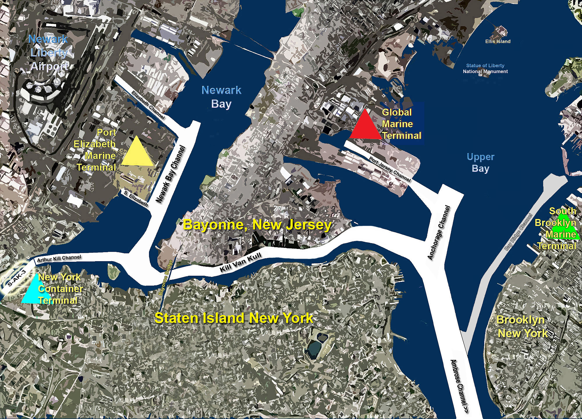
| Partial map of the navigation channels being deepened to 50 feet as part of the Nine Channels Project, 2013. These channels provide shipping access to critical port facilities in New York and New Jersey. USACE New York District Photo |
|
Regional map showing the location of Jamaica Bay marsh island restoration projects. USACE New York District Photo |
Moving forward, it is expected that the New York District and its partners will continue to beneficially use dredged material from future construction and operation and maintenance navigation projects in Jamaica Bay. The Water Resources Development Act of 2020 recommended and authorized construction of five additional marsh islands as part of the Hudson Raritan Estuary Ecosystem Restoration Project. More than 205 acres of additional marsh island habitat would be restored over the next 20 years using more than 1.3 million cubic yards of dredged material. Restoration of Stony Creek Marsh Island, which was fully funded under the Bilateral Infrastructure Law in 2022, will result in 62 acres of habitat and is planned for construction in 2025.
 |
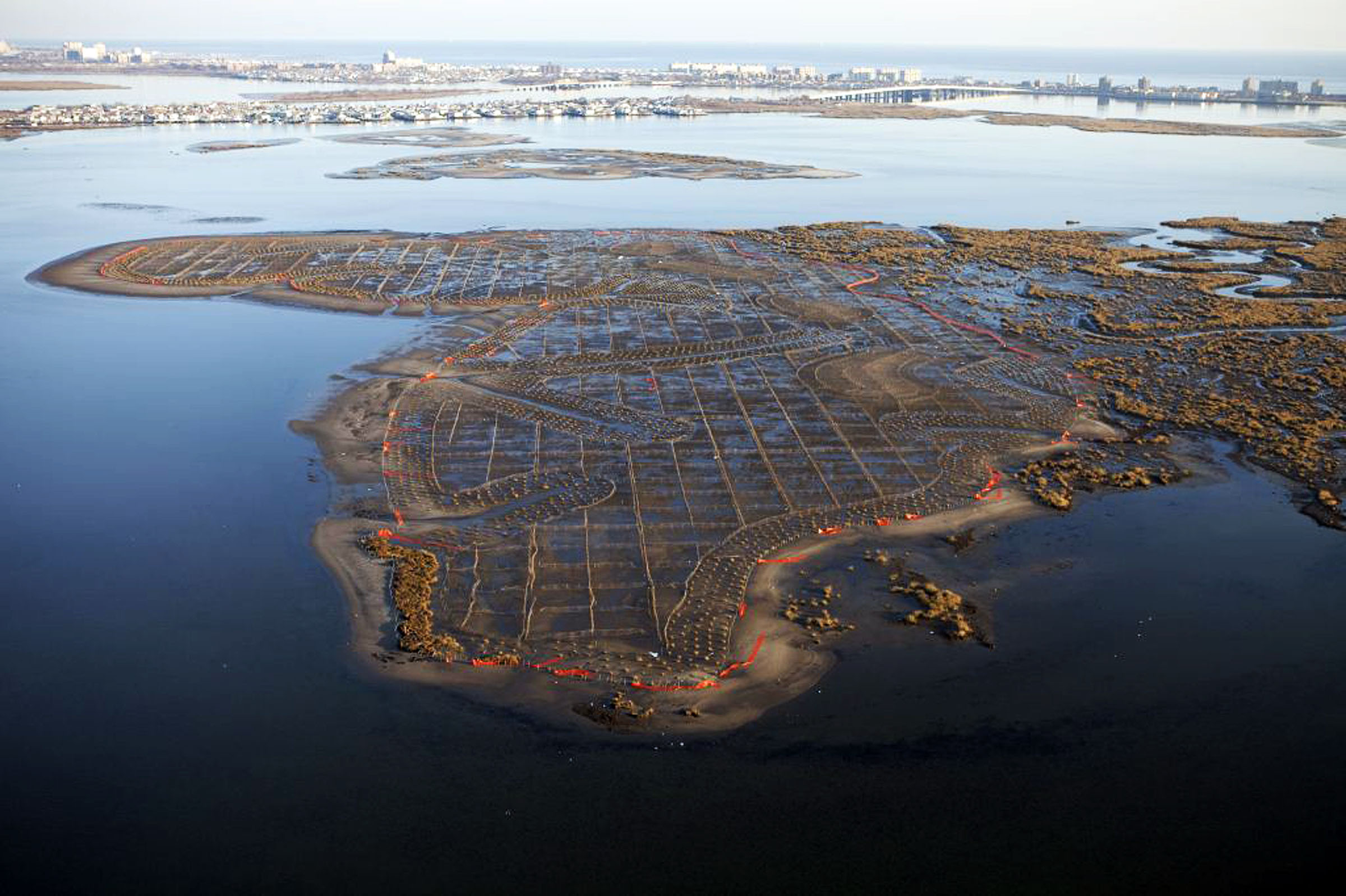
An aerial view of three Jamaica Bay Marsh Islands in Queens and Brooklyn, New York, restored in 2012 by New York District and regional partners. Yellow Bar Hassock Island is in the foreground. Restoring the islands involved placing clean sand over roughly 75 acres of marsh land and planting new vegetation. The effort was part of a larger initiative to restore the Hudson-Raritan Estuary where fresh water from the Hudson, Hackensack, Passaic, Rahway, and Raritan Rivers meets salt water from the Atlantic Ocean and creates a rich ecosystem. Spanning a 25-mile radius encircling the Statue of Liberty, the area includes 1,000 miles of coastline, 1,600 miles of open water, and more than 500 species of birds and fish. USACE New York District Photo |
The Port of New York and New Jersey is the nation’s premier gateway to the world as a conduit of global commerce and a major generator of jobs and economic activity. It is the largest port in the United States and one of the most productive high-volume port operations globally. Encompassing the existing 50-foot navigation channels and surrounding areas, the system includes various terminals and associated channels. The port area encompasses all or part of 17 states, generating the movement of approximately 6.4 million twenty-foot equivalent units per year (as of 2015). The port also has access to rail, road, and inland waterway routes, meaning 23 million local consumers and up to 100 million other customers are within 36 hours. The port’s six container terminals receive vessels from the major ocean carriers that serve nearly every region of the world. Prior to the initiation of the Harbor Deepening Project, and the follow-up Harbor Deepening and Channel Improvements (HDCI) study, channels to the harbor were inadequate to provide access to the large post-Panamax ships, which have drafts of 48 feet or more. The recent HDCI Feasibility Study determined that improvements to navigation within the port by deepening an additional 5 feet to 55 feet can be achieved, thereby enhancing the region’s economy.
The goal will always be to beneficially reuse all the material dredged from the harbor, continue to support the needs of the navigation community, and provide critical environmental restoration and coastal storm resiliency, making the New York and New Jersey Harbor Estuary a world-class estuary.
* * *
October 2022. No. 157.