The Norfolk District Has Kept the Channels of Hampton Roads Open for Half a Century
 |
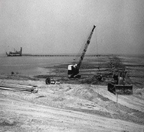
| Construction of the west dike in 1956 |
Commercial and military vessel traffic plying the channels and ports of the Hampton Roads area are dependent upon continuous dredging in order to maintain appropriate depths. A significant part of this effort is the Norfolk District’s Craney Island Dredged Material Management Area. The “island,” located in Portsmouth, Virginia, is a 2,500-acre confined disposal site that receives material dredged from the Hampton Roads channels. Craney Island’s construction was approved by Congress under the River and Harbor Act of 1946 as a modification to the Norfolk Harbor Project and was completed by 1958 at a cost of $6.5 million.
The island has seen its share of history. During the War of 1812, emplacements on Craney Island guarded the channel of the Elizabeth River at the port of Norfolk. The island had a seven-gun fortification and was manned by 580 Regulars and militia in addition to 150 sailors and marines from the U.S.S. Constellation. In fact, modern dredging operations have revealed the likely remains of a shipwreck from the Battle of Craney Island in 1813. A half-century later, early on the morning of May 11, 1862, the C.S.S. Virginia ran aground near Craney Island, after which it was torched. Recent discoveries spurred the Virginia Department of Historic Resources to investigate the possible resting place of the Virginia.
 |
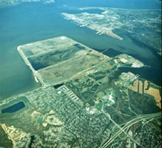
| Aerial View of Craney Island |
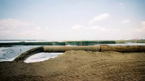
In the early twentieth century, the Corps placed much of the dredged material from various projects in the Norfolk-Hampton Roads areas behind bulkheads and a riprap timber structure on the Craney Island flats. In 1984 the Norfolk District began dividing Craney Island’s dredged area into three cells. One cell is always receiving dredged material while the other two are drying out. Up to five million cubic yards of dredged material are pumped into one of the three cells at Craney Island annually. Spillways, weirs, and excavators are used to dewater the cells. The telescoping weirs, which can be raised and lowered to adjust for varying water levels, allow the dredged material to settle to the bottom, enabling the clear water to flow back into the harbor. The District has a pontoon excavator designed to recover otherwise inaccessible material, due to its low ground pressure. Additionally, the District installed vertical strip drains engineered by the Waterways Experiment Station to increase the area’s capacity.
The disposal area has major economic and environmental benefits for local and regional governments, the military, transporters, industry, and commercial users, who all use the nation’s third–ranking port area for international trade. The Navy’s largest fuel facility in the U.S. is located just south of Craney Island.
The District staff has received recognition for the creation, protection, and preservation of a critical habitat for birds such as the piping plover, least terns, brown pelicans, osprey, and other threatened or endangered species that use the island as a large nesting ground. Audubon Society members have turned the island into a favorite spot for bird watching.
 |
 |
| Dredge material flowing into an active cell |
Dredged material is 50 percent water by weight; as it dries, it shrinks. |
Photo Sources:
U.S. Army Corps of Engineers, Norfolk District
HQUSACE, Office of History
* * *
August 2003