|

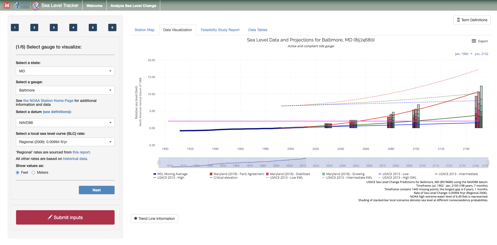
The USACE Climate Preparedness and Resilience (CPR) Community of Practice (CoP) is launching a new version of the Sea Level Tracker (SLT) on the Amazon Web Services (AWS) cloud. The new version of the tool integrates the functionality of a complementary tool, the Sea Level Change Curve Calculator (SLCCC), and adds new capabilities. Specifically, the new tool includes alternative projections of sea level from national and local sources. It also adds the capability to generate a downloadable report so that users can easily apply insights from the SLT to their projects.
As background, USACE has released formal guidance (e.g., USACE 1989, USACE 2013a, USACE 2013b, USACE, 2014) to incorporate sea level change (SLC) in project planning and design. Now, all current and future coastal projects must account for the impacts of changes in local mean sea level (LMSL) throughout a project lifecycle. USACE developed the Sea Level Tracker (SLT) to support the required analysis (per Engineer Regulation 1100-2-8162 and Engineer Technical Letter (ETL) 1100-2-1) and to empower deeper exploration of SLC more broadly.
The SLT allows users to visualize observed changes in sea level and to compare trends to projected changes. The tool shows historical, observed mean sea level (MSL) as measured and reported by National Oceanic Atmospheric Administration (NOAA) tide gauges, along with USACE SLC projections and calculated trends. Additionally, the tool can map these values against critical infrastructure elevation thresholds or other elevations of interest to the user. Finally, the tool enables users to visualize the indirect impacts of changing sea level on extreme water levels (EWLs) as calculated by NOAA and USACE.
Working together, these components can help users align various SLC scenarios with existing and planned engineering efforts, estimating when and how sea level may impact critical infrastructure and planned development activities.
Access the SLT here: https://climate.sec.usace.army.mil/slr_app/
|