Download Instructions: Click on the image you want to download. Once the image is open right click on it and select “save as”. Save it to your computer. Use the photo viewer on your computer to zoom in and out of the maps.
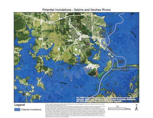
These inundation maps depicting the Sabine and Neches rivers are provided by the United States Army Corps of Engineers Fort Worth and Galveston Districts to assist communities to plan and prepare for flooding.
Lumberton, Bridge City, Deweyville
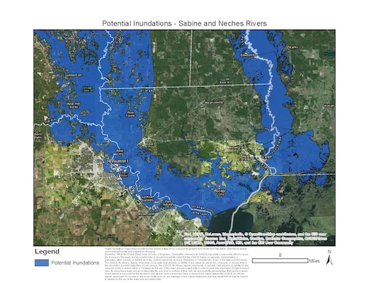
Beaumont, Port of Beaumont

Port of Beaumont, Lamar University
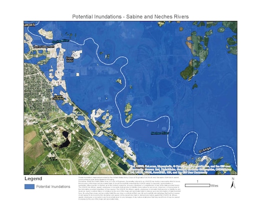
Nederland, Port Neches
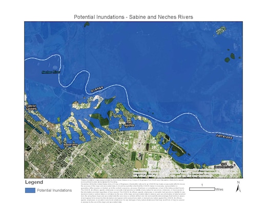
Port Neches, Bridge City, Old River Bayou
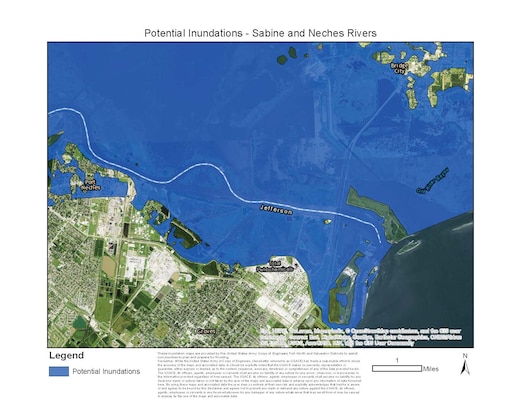
Orange, West Orange
Little Cypress Bayou, Big Bayou, Lost Lake
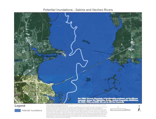
While the United States Army of Corps of Engineers, (hereinafter referred to as USACE) has made a reasonable effort to ensure the accuracy of the maps and associated data, is should be explicitly noted that the USACE makes no warranty, representation or guarantee, either express or implied, as to the content, sequence, accuracy, timeliness or completeness of any of the data provided herein. The USACE, its officers, agents, employees or servants shall assume no liability of any nature for any errors, omissions, or inaccuracies in the information provided regardless of how caused.
The USACE, its officers, agents, employees or servants shall assume no liability for any decisions made or actions taken or not taken by the user of the maps and associated data in reliance upon any information of data furnished here. By using these maps and associated data the user does so entirely at their own risk and explicitly acknowledges that he/she is aware of and agrees to be bound by this disclaimer and agrees not to present any claim or demand any nature against the USACE, its officers, agents, employees or servants in any forum whatsoever for any damages of any nature whatsoever that may result from of may be caused in anyway by the use of the maps and associated data."